

Sri Lanka as India’s Screen Double – line production in sri lanka
Executive summary
For production managers and location scouts, Sri Lanka is not a one-to-one replacement for India; it is a highly efficient selective double. The island’s value lies in how much visual range it compresses into a compact geography: a dense colonial-port capital, Tamil north, tea-country hills, dry-zone plains, mangrove backwaters, semi-arid scrub, and heritage coastlines all sit inside a country of 65,610 square kilometres with around 1,330 kilometres of coastline. In practical terms, that means a schedule can move from a “Mumbai/Delhi street” look to a “Kerala backwater” look and then to a “Darjeeling/colonial hill station” look without the long domestic hops that India often requires.
The strongest Sri Lanka “India cheats” are southern Indian littoral settings, colonial and post-colonial urban streets, Anglo-Indian hill stations, agrarian plains, and arid fringe landscapes. The weaker cheats are heavily iconic India-specific environments: the true Himalayan high-altitude look, dense glass-and-concrete contemporary Mumbai skylines, and unmistakable Indian monuments that cannot be replicated through framing, art direction, and VFX extensions alone. That conclusion is consistent with the kinds of productions that have successfully used Sri Lanka to play India: Indiana Jones and the Temple of Doom, Water, Midnight’s Children, and ITV’s The Good Karma Hospital.
From a producing point of view, the country’s main operational advantages are a centralised foreign-filming permit pathway through the National Film Corporation of Sri Lanka, legally recognised temporary-import routes for professional equipment under ATA/CPD Carnet, multiple international airports, and a crew/equipment base concentrated in Colombo but deployable island-wide. The main constraints are weather timing, traffic and crowd control in Colombo, the relative thinness of crew depth outside the capital, and the need for additional permissions at archaeological, wildlife, forest, port, defence, aviation, and police-controlled sites.


Why Sri Lanka works as an India cheat
Sri Lanka’s usefulness comes from three factors working together. First, the island’s built fabric stilloffers many low-rise streets, colonial facades, markets, rail edges, temple precincts, and waterfrontquarters that can read as mid-century or “timeless South Asia” with comparatively little cleanup. SriLanka Tourism itself pitches Colombo through experiences such as Pettah market and colonial-stylehotels, while UNESCO describes Galle Fort as the best representation of a fortified European-built city inSouth Asia, explicitly defined by the interaction of European planning and South Asian traditions.
Second, the country’s climate pattern is operationally useful rather than merely scenic. Official SriLankan statistics describe four rainfall seasons, with the south-west monsoon from May to September,the inter-monsoon in October to November, the north-east monsoon from December to February, andanother inter-monsoon in March to April. Sri Lanka Tourism also notes that the south-western coastalbelt is typically best from November to April. For production, that means you can often chase the drierside of the island rather than shutting down an entire schedule.
Third, production precedent matters. Sri Lanka has a documented record of replacing Indian locationswhen India was politically, logistically, or visually impractical. Lucasfilm used Sri Lanka for Indian jungle
and village scenes in Temple of Doom; Deepa Mehta rebuilt Varanasi on Bolgoda Lake for Water; Midnight’s Children used Colombo-area locations to play India, Bangladesh and Pakistan; and The GoodKarma Hospital used the Galle district to stand in for southern India. Once a destination has alreadysolved those problems for major productions, the country becomes easier to pitch internally toinsurers, studios, and line producers.
|
Comparison tableIndian look |
Sri Lankan substitute |
Key attributes |
|
Urban Mumbai/Delhi/Kolkatabackstreets |
Colombo Fort, Pettah,Slave Island, Maradana |
Dense market signage, colonial blocks, railedges, government architecture and port-citytexture; best for controlled street sections,bazaars, period urban India, and “generic SouthAsian metropolis” plates. |
|
Goa-like coastand Lusophoneold quarter |
Galle Fort, Unawatuna,Talpe |
UNESCO-listed colonial fortifications, churches,seafront ramparts, boutique lanes, and nearbybeaches; strongest Sri Lankan cheat forPortuguese-influenced west-coast India. |
|
Kerala and SouthIndianbackwaters |
Madu Ganga atBalapitiya, withNegombo Lagoon as theairport-near variant |
Mangrove tunnels, islands, fishing settlements,canals and lagoon edges; excellent for boatmovement, village exteriors, and humid littoralatmospherics. |
|
Colonial hillstation and teafoothills |
Nuwara Eliya, Haputale,Horton Plains, teaestates |
Cool climate, British-era “Little England” identity,Gregory Lake, tea slopes, mist and montanegrassland; strong stand-in for Darjeeling/Assam/Nilgiris and selected Himalayan foothilllooks. |
|
Rajasthan/Kutcharid fringe anddesert-roadinserts |
Hambantota, Bundala,Yala outskirts,Hambantota salt flats |
Dry semi-arid scrub, lagoons, salt flats and openroads; convincing for arid-western India fringes,not for iconic deep-Thar dune fields. |
|
Tamil Nadu/Coromandel coastand Tamil urbantexture |
Jaffna Peninsula, Nallur,Jaffna Fort, Delft/KKScorridor |
Tamil-majority cultural landscape, Hindutemples, fort, arid palms and low-rise northernstreets; particularly useful for Tamil-speakingcoastal or small-city south Indian material. |
|
North Indianplains and centralIndian agrarianroads |
North Central dry zonearound Habarana,Polonnaruwa andAnuradhapurahinterland |
Flat to gently undulating dry-zone plains, tanks, paddy belts and long roads; strongest when iconic Sri Lankan Buddhist monuments are excluded from frame. This is an inference from the region’s dry-zone landscape and Sri Lanka’s broader terrain mix. |
Detailed location cheat sheet
Colombo Fort, Pettah, Slave Island and Maradana are the island’s most flexible urban India cheat. Pettah gives you the signage density, mixed traffic, handcart-and-shopfront clutter, and tight commercial streets that can read as older Mumbai, Delhi, Chennai, Kolkata, or a non-city-specific SouthAsian downtown. Fort and adjacent central Colombo add colonial facades, institutional buildings, and port-adjacent urban scale. Weather window: driest months are usually November to April on the south-western side. Access: Bandaranaike International Airport at Katunayake is the main international gateway; Ratmalana is the smaller Colombo airport; Colombo Port is the principal seaport. Crew/equipment: this is the deepest crew base on the island, and Televisual reports that most of Sri Lanka’s filmmaking infrastructure is concentrated in Colombo. Permits: apply through the National FilmCorporation; add police/municipal permissions for street control and SLPA/defence clearances when you work close to port or restricted zones. Pros: fastest mobilisation, best equipment depth, strongest art-department support. Cons: traffic, ambient noise, and the need for heavier crowd and signage management than in resort or rural zones. Exact local street-closure fees are not publicly specified in the sources reviewed.
Galle Fort with Unawatuna and Talpe is the cleanest way to fake Goa-like India. UNESCO describes Galle as a South Asian fortified city where European planning and South Asian architectural traditions meet, and the fort sits on the south-west coast with beaches and surf-facing edges minutes away. That combination makes it unusually useful: one recce can cover colonial lanes, churches, lighthouse/rampart exteriors, small hotels, beach bars, and palms. Weather window: generally November to April on the south-west coast. Access: Galle Fort is about 113 kilometres from Colombo; the usual air gateway is Bandaranaike, with road access from Colombo; the relevant seaport is Galle Port. Crew/equipment: local crews can work here, but the heavier package still usually comes from Colombo. Permits: NFC plus heritage/archaeology permissions for protected structures or more invasive work inside the fort; exact heritage fees were not publicly specified in the materials reviewed. Pros: high production value with minimal dressing. Cons: heritage sensitivity, parking/vehicle restrictions inside or around the fort, and tourist footfall during peak months.
Madu Ganga at Balapitiya, with Negombo Lagoon as a near-airport alternative, is the best Kerala/backwater cheat. Sri Lanka Tourism material describes Maadu Ganga as an unspoilt waterway with mangroves and 64 small islands; Sri Lanka Tourism also highlights Negombo lagoon and the town’s fishing-port heritage. For location scouts, the strategic distinction is simple: Balapitiya gives the more lyrical, less urbanised backwater look, while Negombo gives a usable canal/lagoon/fish-market texture much closer to the airport. Weather window: south-western coast and lagoon systems generally play best from November to April, although water landscapes remain usable outside those months if the look tolerates rain. Access: Balapitiya is around 80 kilometres south of Colombo; Negombo sits by the main airport. Marine freight normally routes through Colombo, with Galle as a southern alternative. Crew/equipment: boat safety, marine transport, and waterproofing become the key line items; camera and lighting packages generally come from Colombo. Permits: NFC plus site-specific local approvals; if any environmentally sensitive protected wetland or canal section is involved, expect additional agency permissions. Pros: one of the most convincing South Indian littoral cheats in the region. Cons: weather shifts, boat turnaround time, insect exposure, and limited road width around some launch points.
Nuwara Eliya, Haputale, Horton Plains and surrounding tea estates are Sri Lanka’s most bankable hill-station double. The official tourism material repeatedly frames Nuwara Eliya as “Little England”, andGregory Lake plus the retained colonial architecture give you instant proof of concept. Horton Plains adds altitude at roughly 2,100 metres, while the Central Highlands UNESCO site confirms the broader montane/foothill ecology. For international production, this package can convincingly play Darjeeling,Assam tea country, Nilgiri-type hill stations, or selected Himalayan foothill environments, but it will not replace snow line or high-alpine Himalayan geography. Weather window: safer from roughly January toApril for cleaner hill-country weather; the south-west monsoon and inter-monsoon periods raise rain and mist risk. Access: inland road access from Colombo/Bandaranaike is standard; charters connect through Ratmalana and domestic operators. Colombo Port is the usual freight gateway. Crew/equipment: estates and bungalows are workable, but base your main technical crew from Colombo. Permits: private-estate negotiations are often as important as NFC permissions; protected highland parks require forest/wildlife approvals. Pros: very high production value for period India. Cons: weather volatility, winding roads, slower unit moves, and fewer large urban support services on location.
Hambantota, Bundala and the Yala outskirts are a credible cheat for western Indian arid-edge landscapes. Official tourism describes Yala as a dry semi-arid climatic region receiving most rain during the north-east monsoon, while Sri Lanka Tourism’s cruise material points to Hambantota’s large salt flats. Together with Bundala’s lagoons and salt pans, that produces a strong palette for salt-road inserts, dry coastal scrub, low-relief dunes, trucking roads, and “Rajasthan/Kutch fringe” imagery. Weatherwindow: best outside the north-east monsoon peak; for many productions, May to September can bevery workable in the south-east dry zone. Access: Mattala Rajapaksa International Airport and Hambantota International Port are the obvious gateways. Crew/equipment: technical support still mostly trucks in from Colombo, although south-coast accommodation/logistics are easier now than a decade ago. Permits: NFC plus wildlife/environmental approvals if working in or near protected zones; salt-works access depends on operator permission, and fees were not specified publicly in the sources reviewed. Pros: uncommon look for the region, especially when India is unavailable. Cons: limited shade, heat management, wildlife constraints, and the fact that this cheats arid India better than it cheats iconic sand-dune Rajasthan
Jaffna Peninsula, including Jaffna town, Nallur, the Fort and the Kankesanthurai corridor, is the island’s most credible stand-in for Tamil north-coastal India. Sri Lanka Tourism describes Jaffna as a place of colonial charm and vibrant Tamil culture, and the SLTDA attractions material notes the area’s predominantly Tamil profile. This is a crucial distinction for casting and language planning: if the script wants a Tamil-speaking streetscape without the density and cost profile of Chennai, Jaffna is worth serious recce time. Weather window: in practice, the north often works best outside the north-east monsoon; this is an inference from Sri Lanka’s monsoon pattern and the north’s geography. Access:Jaffna International Airport at Palaly and Kankesanthurai Port. Official tourism notes that reachingJaffna is now straightforward and no longer requires security checks or clearance. Crew/equipment:local support exists, but full camera/grip/lighting depth still generally comes from Colombo. Permits:NFC baseline plus any local civic, temple, or port/security permissions. Pros: distinct Tamil cultural identity and strong small-city texture. Cons: thinner hotel/technical depth than Colombo or the south-west, and longer replenishment cycles for specialist kit.
The North Central dry zone around Habarana, Polonnaruwa and Anuradhapura hinterland is the most useful Sri Lankan cheat for “North Indian plains” when what you actually need is an agrarian or period road movie look rather than recognisable Indo-Gangetic monuments. Official Sri Lanka material emphasises the scale of the dry zone and inland water systems, and the Yoda Ela example underscores the region’s dry-zone character. If you avoid frame-contaminating Sri Lankan identifiers such as stupas and iconic archaeological facades, the wider roads, tanks, fields, scrub, and sun-baked palette can stand in for parts of Uttar Pradesh, Bihar, Madhya Pradesh, or interior Deccan belts. Weather window: late dry-season and shoulder periods are generally easiest; plan around the north-east monsoon. Access:road from Colombo/Bandaranaike is standard; Trincomalee or Colombo are the practical marine gateways for heavy freight, depending on routing. Crew/equipment: mobile support package fromColombo. Permits: NFC plus archaeology permissions if any protected historical site appears, whether directly or in the background. Pros: big-sky roads and rural scale. Cons: careful framing is essential, because Sri Lankan heritage markers are visually specific. Exact access and site fees vary and are often unspecified in public-facing material.
Productions that proved the approach
|
Production |
Year and production company |
How Sri Lanka doubled forIndia |
Sri Lankan locations used |
Sources |
|
IndianaJones and the Temple of Doom |
1984; Lucas filmLtd., distributed by ParamountPictures. |
Lucas film’s own material says Sri Lanka was used for the Mayapore village,Indian jungles and the rope-bridge material afterIndia fell through; broader production accounts say Kandy/Victoria Dam were central to the substitute. 23 |
Kandy area and theVictoria Dam vicinity;Sri Lankan actors played the villagers. |
24 |
|
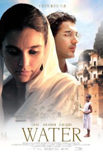
Water |
2005; DavidHamiltonProductions /Hamilton-Mehta. |
Set in 1938 colonial India/Varanasi, then relocated to Sri Lanka after protests in India; Deepa Mehta’s director’s statement confirms the project was resurrected in Sri Lanka.Asian Film LocationServices states theVaranasi ghats were recreated at Bolgoda Lake near Colombo. |
Bolgoda Lake nearColombo with purpose-built ghats and associated Colombo-area work. |
26 |
|
Midnight’s Children |
2012; Hamilton-MehtaProductions. |
Public production reporting says principal photography ran in SriLanka; contemporary reports say 65 Colombo-area locations were altered to masquerade as India, Bangladesh and Pakistan, while exhibition notes describe Sri Lanka as “the best possible place to recreate the India of the past century.” |
Colombo and surrounding colonial buildings, schools, churches, streets and transport nodes; the precise public counts differ between sources, but the Colombo-region substitution is clear. |
31 |
|
The Good Karma Hospital |
2017–2022 filming cycle documented;Tiger AspectProductions forITV, with AcornTV/AME on series four. |
ITV states the drama is set in southern India and shot on location in Sri Lanka;Televisual reports it was shot in Galle. Secondary location reporting places recurring footage in Unawatuna and Thiranagama, both inGalle District. |
Galle District, including Galle, and public reports place key recurring locations in Unawatuna and Thiranagama |
The notable pattern is that all four productions solved a slightly different problem. Temple of Doom needed India-like adventure terrain quickly; Water needed a politically safer way to recreate a sacredIndian city; Midnight’s Children needed period South Asia across multiple countries and decades; TheGood Karma Hospital needed an affordable, repeatable southern-India TV world over several series. SriLanka worked in each case because it allowed a mix of authentic exteriors, manageable scale, and art-direction control.